|
|
Section 9Tidal Waters |
|
|
Section 9Tidal Waters |
9.6 |
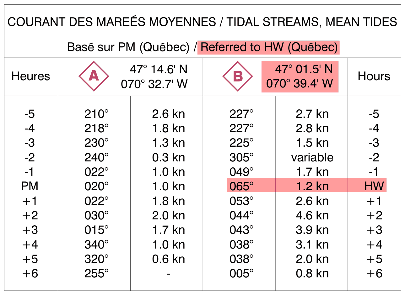
"Tidal Diamonds" |
While the Canadian Tide and Current Tables are the primary source for tidal data, nautical charts can also provide valuable information. An example are the flood and ebb arrows that indicate the direction and speed of tidal current. Two other chart symbols appear on some charts where complex tidal currents can't be adequately illustrated by a pair of arrows. These are a set of symbols where one marks a location on the chart, and the other provides tabular data. |
 |
|
The location marker is commonly called a "tidal diamond" due to the shape of the symbol. It's printed in magenta ink. Information about a tidal-diamond location appears in a table positioned elsewhere on the chart. The table shows the rate (drift) in knots, and direction (set) in True degrees for times before and after mean-tide high water at the reference port on the applicable date. The table may contain data for more than one tidal diamond. |
|
|
This table shows the co-ordinates and data for two tidal diamonds, "A" and "B", and that both are referenced to the tide tables for Quebec. At high water (HW in the Hours column or PM under Heures) at the reference port, the current at tidal diamond "B" has a set 065°, and the drift is 1.2 knots. Two hours after high water (+2), the set/direction is 044°, and the drift/rate is 4.6 knots. |
|
|
|
|
|
|